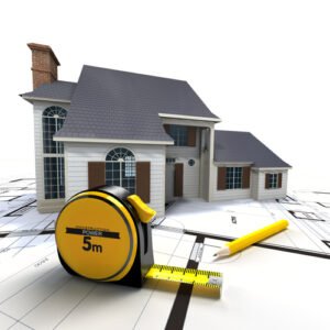
Get Accurate Roof Measurement Reports | Aerial Roof Measurement


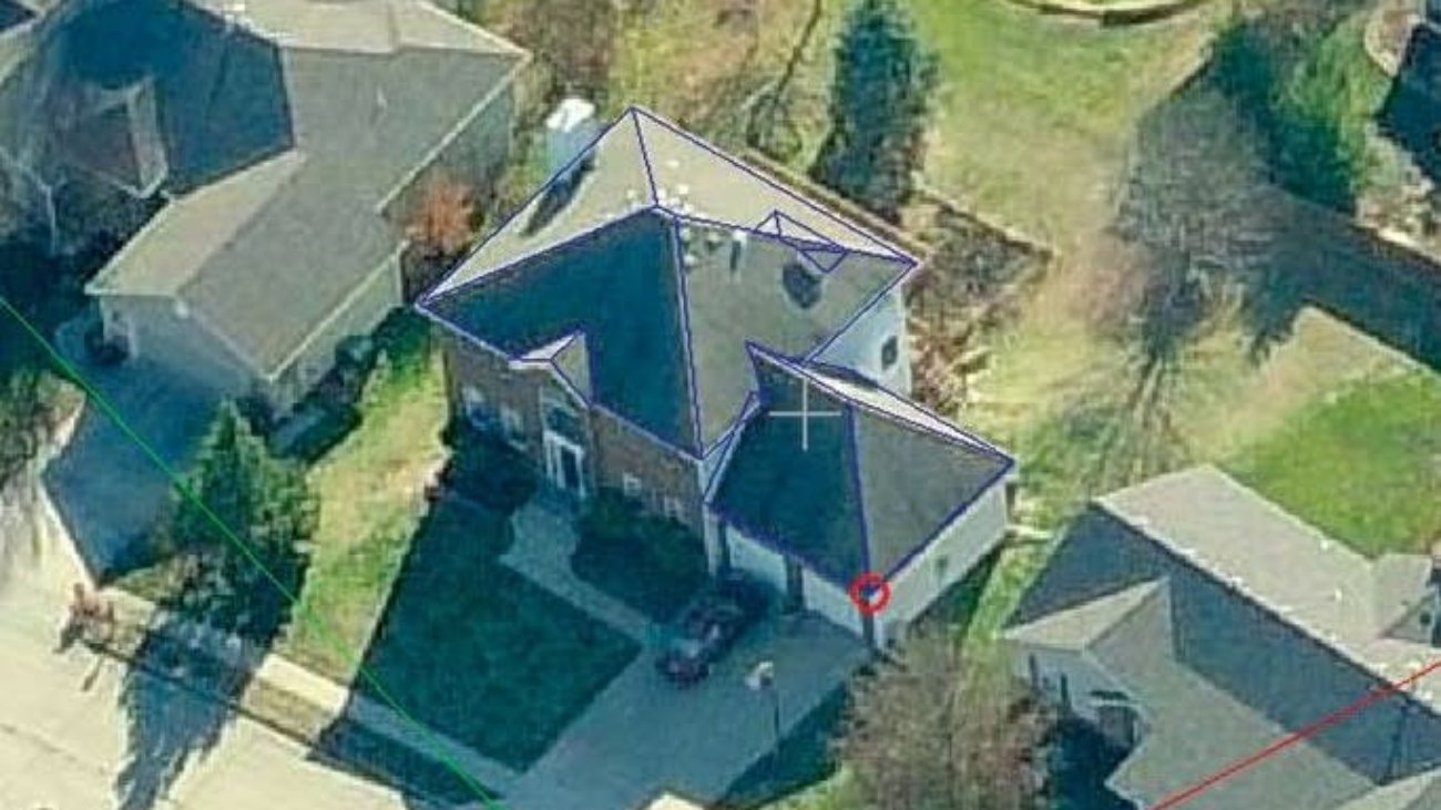
Sky Roof Measure is proud to offer Aerial Roof Measurement Services to the construction industry. We use the latest in technology and highest quality aerial and satellite images to create our roofing measurements into an Xactimate or Symbility Sketch. Using these images together with our web based software, we are able to create a roof take-off that is just as accurate as on-site measurements. In fact, our roofing measurements have been proven accurate to within 2% – 5% and fastest report delivery compared to other Aerial Roof Measurement Companies.
Accuracy Is The Key To Success. No Other Words Can Explain The Importance. Our Aerial Roof Measurement Reports Are Prepared By Trained CAD Technicians Followed By A 3 Step Verification Process By A Quality Assurance Professional, Certifying Absolute Data Accuracy On Every Report We Deliver.

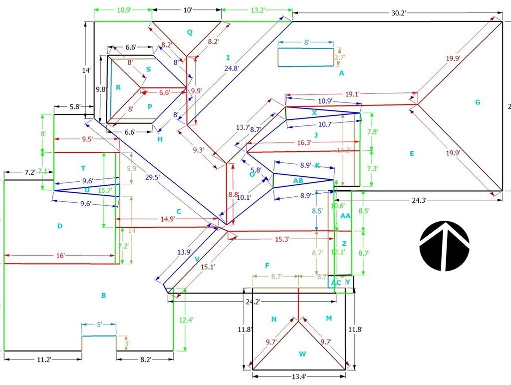
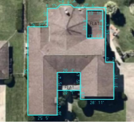
The Roof Measurement Report provides a detailed analysis of your roof layout and all the critical dimensions. … This report saves your time and enables accurate roof estimates for a roof repair or replacement. This is a professional grade report used for use by licensed roofing contractors or insurance companies. The Roof Measurement Report provides a detailed analysis of your roof layout and all the critical dimensions. … This report saves your time and enables accurate roof estimates for a roof repair or replacement. This is a professional grade report used for use by licensed roofing contractors or insurance companies.
Get accurate roof measurements

The Roof Measurement Report provides a detailed analysis of your roof layout and all the critical dimensions. … This report saves your time and enables accurate roof estimates for a roof repair or replacement. This is a professional grade report used for use by licensed roofing contractors or insurance companies.
Getting detailed and accurate rooftop measurements is important for a variety of applications. Perhaps you work for a construction firm. You may need detailed diagrams of the roof with accurate measurements of the ridges, valleys, hips, eaves, and a clear visual understanding of where vent pipes and chimneys are located on the roof.
You could also be performing a rooftop inspection and need to properly assess a damaged area for an accurate estimate for repair. Or perhaps you need to calculate the area of your roof to estimate the cost of getting it re-shingled or get a quote for a solar panel installation.
Drones present a unique opportunity for getting a clear view of your rooftop and allowing you to get precise roof measurements. A variety of roof measuring applications and programs already take advantage of high-resolution drone imagery to get accurate roof measurements.
Don’t Hand Measure a Roof, Get A Roof Report Using Accurate Satellite Roof Measurements at Sky Roof Measure. We’re dedicated to saving your time, reducing your cost of business, improving your customer service, and profitability by providing your business with automated Aerial Roof Measurements. Our reports are unique because They are just as accurate as on-site measurements, Our valuable customers confirm this statement. Are you one of them? Try the technology that is saving your time, money and same day delivery. See how it’s all possible by signing up and ordering a roof report for yourself.
The Roof Measurement Report provides a detailed analysis of your roof layout and all the critical dimensions. Our full color report provides the detailed lengths, pitch and areas of every surface plane and edge. This report saves your time and enables accurate roof estimates for a roof repair or replacement. This is a professional grade report used for use by licensed roofing contractors or insurance companies. You will receive the report in .PDF format by email within 1-3 days.
Our goal at Sky Roof Measure is to streamline your day to day operations by automating your employees and allowing them to work more efficiently with the help of our interactive Roof Reports. When your roof report is ready, it is not just emailed to one person, or available for download into a single desktop application, it is available to anyone in your company using a web based user account. All your reports saved on our database and you can view and download any time as per your convenience. Our 3D Roof reports include Aerial Images, rakes, flashing, valleys, ridges, multiple slope areas, pitch, linear measurements, total squares, recommended waste, etc. Our System can Export and import file formats such as XML,RFX,DFX/DWG and WRL.
For a tool that can be so valuable to your company, aerial roof measurements are actually quite simple. Planes or drones capture images of residential and commercial properties from the sky. From these images, a report with accurate measurements of a roof’s area, length, and pitch is generated. Details typically include measurement of a roof’s ridges, hips, valleys, rakes, eaves, flashing, and step flashing.
Our aerial roof measurement reports are drafted by expert CAD technicians and reviewed by a quality assurance professional, certifying absolute data accuracy on every report. Precision is paramount at Sky Roof Measure, and that’s how we guarantee a 95% or better accuracy rate on every plane, eave, rake, ridge, hip and valley. Be confident in your bids, and submit estimates that align to your profit goals.

Follow these steps for calculations you’ll use to learn how to measure for wood siding:
In roofing, one square equals 10 X 10 ft., or 100 sq. ft. This unit of measurement determines how many shingles you’ll need for every 100 sq. ft. of rooftop. As you prepare for your roofing project, you’ll use squares to determine the amount of roofing materials you need, from asphalt shingles down to the underlayment.
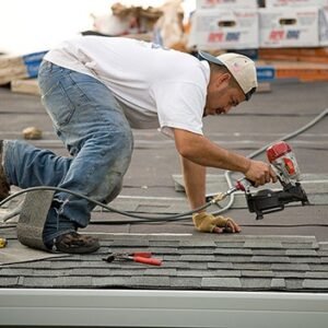
Before beginning, make sure you can safely access your roof—if you can’t, contact a roofing professional for help.
Grab your measuring tape, level, pen and paper, roof safety equipment, and your ladder. With these in hand, you can measure your roof in five simple steps.
You can use an online shingle calculator or roof slope calculator to help run the calculations. Once you know the total number of squares you want to cover, consider adding up to 10% in overage to account for error and installation.
It’s important to measure your metal roof before you begin your project so that you can estimate your metal roofing material as accurately as possible. Here’s our step-by-step guide for measuring the total roof area for installation:
Step 1: Start by sketching out a top-down view of your home’s roof. Don’t worry about getting the scale or dimensions perfect yet.
Step 2: Measure the length of your roof. Do this by measuring from one of the edges to the opposite side. Write down the number for the next step.
Step 3: Next, figure out the width of the metal that you’re installing. Then, divide the length of your roof by the width of the metal. For example, your roof’s length might be 30 linear feet (360 inches). Divide that by 24-inch standing seam roofing, and you get 15. This will be the number of panels you’ll need for one side of the roof.
Step 4: Repeat Step 3 for the other side of the roof. It’s important to measure both sides in case they slightly differ in size.
Step 5: Measure from the fascia board (board attached to the roof joists) to the ridge (peak) of the roof. This will determine the length of the metal roofing panels you’ll need for one side of the roof.

Efficient, cost-effective roofing work depends on your ability to quickly and accurately gather measurements and assess the current roof condition. Improve your responsiveness to customers by replacing countless site visits with online roof measuring tools using recent aerial photos. Take traffic and safety risk out of the equation and produce fast, accurate quotes with the power of high resolution aerial maps.
It’s quite a challenge to fly over the right location during the perfect window in time late winter or early spring. You want the capture to be snow-free, but must act quickly before the trees go green. You also need cooperative clear skies and adequate daylight – more difficult during short winter days. However detailed aerial capture plans may be, survey teams must still adapt on the fly and follow opportunity. You must learn to adapt quickly, and nimbly deploy aerial assets as opportunities present.
Take Chicago, for example – the time between last snow and first bloom can often be measured in days, or at best a few weeks. Clear weather aerial capture is difficult, but the ability for roofers to accurately measure what’s typically obscured by nature is essential.
There has been a move away from the satellite imagery that dominated measuring and site-surveying for the previous decade. There’s a couple of reasons for this, the main one being quality. No matter how good the camera on a satellite may be, it’s still in outer space. By being closer to the earth’s surface, a high-quality camera on an airplane is going to capture a clearer, sharper image.
What about imagery from a drone? With drone-captured imagery, you have the same problem you have with satellite captures, distance. Drone cameras historically have had wide-angle lenses, causing distortion of rooflines at low altitudes. We have no problem with drone-captured imagery, it’s often the best, and sometimes the only source for rural addresses that lack coverage by satellite and aerial imagery. To overcome the distortion, we suggest flying your drone to a minimum altitude of 400 feet. At that height, any visible distortion should be negligible, and you can make good use of your up-to-date drone imagery! That leads us to our next point…
Aerial imagery provides distorted, flat one-dimensional images that are often taken at a poor viewing angle. HOVER’s technology creates a highly accurate interactive 3D model of your project that streamlines communication on the job. Whether you’re pitching a prospective client, planning with your superintendent or installation group, HOVER’s 3D model is an invaluable asset for your entire process, from sales through completion.
Simply put, aerial measurements cannot compare to the accuracy and detail available with Sky Roof Measure’s timely, convenient features. Save time and money and surpass your client’s expectations when you base your projects on Sky Roof Measure measurements and models.
It’s true that the nail gun didn’t replace the hammer. That said, no professional is going to attempt to put on a roof without an air compressor nearby. The same can be said for measuring roofs from your desk… it’ll never replace a measuring tape completely but it sure gives you a head start. Please, take a moment to learn how Sky Roof Measure can improve your bottom line while keeping you off unprofitable roofs. Aerial roof measurements are here. Now is the time to save time, money, and allow your business to run at a much higher profit margin.
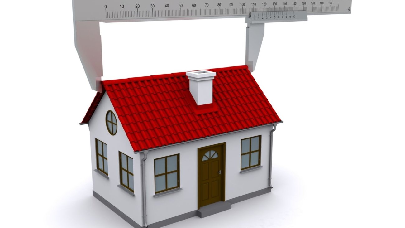
Sky Roof Measure is proud to offer Aerial Roof Measurement Services to the roofing industry. We use the latest in technology and highest quality aerial and satellite images to create our roofing measurements. Using these images together with our web based software, we are able to create a roof take-off that is just as accurate as on-site measurements. In fact, our roofing measurements have been proven accurate to within 3%-5% and fastest report delivery compare to other Aerial Roof Measurement Companies.
We have also Integrated with other Aerial measurement Services companies to provide efficient reporting services. The introduction of house measurement reports affirms, We give commitment to continue creating solutions through technology for the insurance and construction industries.
We have experience in 2D and 3D modeling of aerial imagery houses and provide accurate measurements to roofing contractors and save costs with profitable operation and increase the benefits. We provide roof measurement for houses, ranging from small residential buildings to a huge commercial buildings with coverage of all kinds of roofs and dormers like Hips, Gables, Mansards, Gambles, Porch, symmetrical and asymmetrical roofs etc.,
Accurate roof measurements reports to save you time and money. Improve roof estimate accuracy for your customers for any project.